Modern vehicles, aircraft, robots, ships, and emergency teams often depend on satellite signals to know where they are and where they are going. However, GPS-denied navigation has become a critical capability because satellite navigation can be unavailable, unreliable, jammed, spoofed, blocked, or degraded by the environment. In these situations, navigation systems must continue operating safely by combining sensors, maps, algorithms, and intelligent decision-making.
TLDR: GPS-denied navigation is difficult because systems lose access to the most common source of positioning data. The biggest challenges include signal blockage, sensor drift, spoofing, complex environments, and limited computing resources. Modern systems overcome these issues by using sensor fusion, inertial navigation, visual positioning, lidar, radar, terrain matching, and artificial intelligence. The most reliable solutions do not depend on a single technology, but combine multiple sources of information to maintain accurate and resilient navigation.
Why GPS-Denied Navigation Matters
Global Positioning System signals are weak by the time they reach Earth. They can be blocked by mountains, buildings, tunnels, forests, underground spaces, underwater environments, and dense urban areas. They can also be disrupted intentionally through jamming or spoofing, creating serious risks for autonomous vehicles, drones, military systems, maritime operations, mining equipment, and search-and-rescue teams.
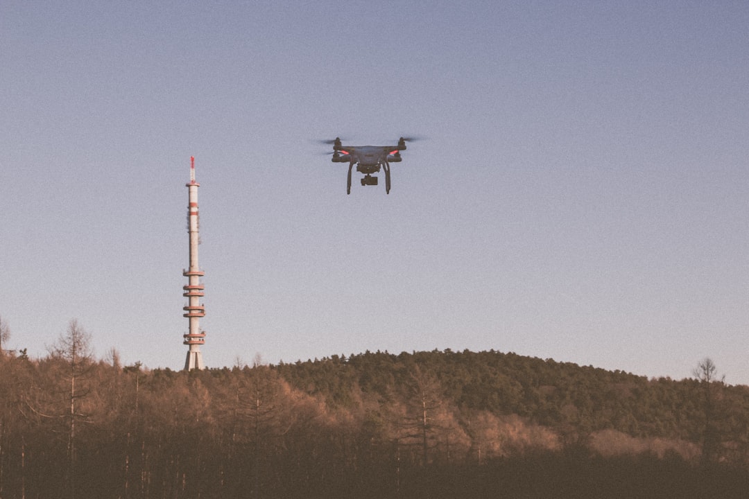
For this reason, navigation systems are increasingly designed to operate in contested, cluttered, or signal-poor environments. A drone inspecting a bridge, a robot moving through a warehouse, or a vehicle traveling through a tunnel cannot simply stop functioning when GPS disappears. These systems must estimate position, orientation, velocity, and route using other methods.
Challenge 1: Signal Blockage in Complex Environments
One of the most common problems in GPS-denied navigation is physical signal blockage. Tall buildings create urban canyons, tunnels eliminate satellite visibility, and indoor environments prevent GPS receivers from obtaining reliable fixes. Even partial blockage can cause errors because the receiver may see only a few satellites or may receive reflected signals instead of direct ones.
Navigation systems overcome this challenge by using alternative positioning technologies. These may include:
- Inertial Measurement Units: Sensors that measure acceleration and rotation to estimate motion.
- Visual Odometry: Cameras that track visual features in the environment to estimate movement.
- Lidar Mapping: Laser-based systems that build 3D maps and compare current surroundings with known structures.
- Radar Navigation: Radio-based sensing that works better than cameras in dust, fog, smoke, or darkness.
- Wi-Fi, Bluetooth, or UWB Positioning: Local radio signals used for indoor localization.
By combining these methods, a system can keep navigating even when satellites are invisible. For example, an autonomous warehouse robot may use wheel encoders, lidar, and indoor beacons to move accurately without GPS.
Challenge 2: Inertial Sensor Drift
Inertial navigation is one of the foundations of GPS-denied operation. An Inertial Navigation System, or INS, uses accelerometers and gyroscopes to estimate position and orientation. The advantage is that it does not require external signals. The disadvantage is that small measurement errors accumulate over time, causing drift.
Even a high-quality inertial sensor can gradually become inaccurate if it is not corrected. Low-cost sensors, such as those used in small drones or consumer robots, may drift much faster. Over minutes or hours, the estimated position can move far away from the true position.
Systems overcome drift through sensor fusion. This means they combine inertial data with other sources, such as camera images, lidar scans, terrain data, magnetic readings, wheel odometry, barometric altitude, or known map features. Algorithms such as Kalman filters, particle filters, and graph-based optimization can continuously correct accumulated errors.
For instance, a ground vehicle may use inertial data to estimate movement between landmarks, then use a camera or lidar to recognize road signs, lane markings, buildings, or other features. Each recognized feature helps reset or improve the position estimate.
Challenge 3: Spoofing and Jamming
GPS-denied navigation is not always caused by natural obstacles. In defense, aviation, maritime, and infrastructure security, systems may face intentional interference. Jamming overwhelms GPS receivers with noise, while spoofing sends false signals that trick a receiver into calculating the wrong location or time.
Spoofing can be especially dangerous because the system may believe it is receiving valid satellite data. A ship, drone, or vehicle could be misled without immediately detecting the attack. This makes resilience and verification essential.
To overcome these threats, systems use several protective measures:
- Signal Authentication: Checking whether satellite signals appear legitimate.
- Multi-constellation GNSS: Comparing GPS with Galileo, GLONASS, BeiDou, or regional systems.
- Direction finding antennas: Detecting whether signals are arriving from suspicious directions.
- Cross-checking sensors: Comparing GPS data with inertial, visual, radar, or map-based estimates.
- Anomaly detection: Using software to identify sudden jumps, impossible speeds, or inconsistent timing.
When suspicious satellite data is detected, the navigation system can reduce trust in GPS and shift to other sensors. The strongest systems treat GPS as only one input, not as the single source of truth.
Challenge 4: Poor Visibility and Harsh Conditions
Cameras are valuable for GPS-denied navigation because they can identify landmarks, track motion, and support simultaneous localization and mapping, often called SLAM. However, cameras struggle in darkness, glare, fog, smoke, rain, snow, dust, and featureless environments. A white hallway, open desert, or dark tunnel may provide too little visual information.

To overcome this limitation, systems often combine cameras with lidar, radar, thermal imaging, sonar, or structured light. Lidar can provide accurate 3D geometry, while radar can function in poor weather and low visibility. Thermal cameras can detect heat signatures when visible light is limited. Underwater vehicles may use sonar because radio signals and optical visibility are often poor beneath the surface.
The best choice depends on the environment. A self-driving car may rely on lidar and radar in fog, while a mine inspection robot may use lidar and inertial navigation in darkness. A submarine or underwater drone may use sonar, dead reckoning, and acoustic beacons.
Challenge 5: Map Dependence and Changing Environments
Many GPS-denied systems rely on maps. These maps may be visual, geometric, magnetic, acoustic, or terrain-based. The system compares sensor readings with the map to determine position. This approach can be highly accurate, but it creates a new challenge: the map must be reliable and current.
In real-world environments, conditions change. Construction sites move, warehouses are rearranged, roads close, shelves shift, trees grow, debris appears, and lighting conditions vary. If a system relies too heavily on an outdated map, it may become confused or make unsafe decisions.
Systems overcome this challenge by using adaptive mapping and real-time updates. SLAM allows a robot or vehicle to build and update a map while navigating. Cloud-based fleet systems can also share map changes across many robots or vehicles. If one vehicle detects a new obstacle or changed route, others can benefit from that information.
However, map updates must be handled carefully. The system must distinguish between temporary objects, such as a parked vehicle, and permanent changes, such as a new wall. Advanced algorithms classify environmental features and decide what should be added to the long-term map.
Challenge 6: Limited Processing Power and Energy
GPS receivers are relatively efficient, but GPS-denied navigation can require heavy computation. Cameras, lidar, radar, SLAM, artificial intelligence, and sensor fusion may consume significant processing power and battery energy. This is especially difficult for small drones, handheld devices, wearable systems, and micro-robots.
To overcome this challenge, engineers design systems that balance accuracy, speed, and power consumption. Some systems use optimized processors, edge AI chips, or dedicated sensor-fusion hardware. Others reduce computation by selecting only the most useful sensor data or switching sensors on and off depending on the situation.
For example, a drone may use a lightweight inertial system during stable flight, activate cameras when entering a complex area, and use lidar only when obstacle avoidance becomes critical. This type of context-aware navigation helps extend mission time while maintaining safety.
Challenge 7: Featureless or Repetitive Environments
Navigation systems often depend on recognizable features. A visual system tracks corners, edges, textures, and landmarks. Lidar detects shapes and surfaces. Radar identifies structures and movement. But some environments are difficult because they are either featureless or repetitive.
Examples include long tunnels, corridors, open fields, deserts, snow-covered landscapes, oceans, and warehouses with identical aisles. In these places, the system may struggle to determine whether it has moved forward, sideways, or returned to a similar-looking location.
Systems overcome this by using additional constraints and references. Wheel odometry, inertial motion, magnetic field patterns, barometric pressure, acoustic beacons, artificial landmarks, or pre-installed radio anchors can improve reliability. In some facilities, operators place visual markers, QR codes, reflectors, or ultra-wideband anchors to help robots localize more accurately.
In outdoor environments, terrain-relative navigation can be useful. Aircraft or missiles may compare radar altitude, terrain contours, or camera imagery with stored terrain maps to determine position without GPS.
Challenge 8: Timing and Synchronization
GPS provides not only location, but also highly accurate timing. Many systems use GPS time for synchronization across sensors, communication networks, power grids, and financial infrastructure. When GPS is unavailable, timing errors can affect navigation performance and system coordination.
Navigation systems overcome this with precision clocks, internal timing systems, network-based synchronization, and cross-sensor calibration. High-end platforms may use atomic clocks or chip-scale atomic clocks to maintain accurate time during GPS outages. Smaller systems may rely on stable oscillators and software correction.
Accurate timing is especially important when fusing data from multiple sensors. If a camera image, lidar scan, and inertial measurement are not properly synchronized, the system may calculate the wrong position or misinterpret motion.
How Sensor Fusion Makes GPS-Denied Navigation Reliable
The central strategy behind most GPS-denied navigation systems is sensor fusion. No single sensor is perfect. Cameras are rich in detail but sensitive to lighting. Inertial sensors are self-contained but drift. Lidar is accurate but can be expensive and affected by weather. Radar is robust but lower in resolution. Maps are valuable but may become outdated.
Image not found in postmetaBy combining multiple sensors, the system can compensate for individual weaknesses. If GPS becomes unavailable, inertial sensors maintain short-term motion estimates. If inertial drift increases, lidar or visual landmarks correct the path. If visibility is poor, radar or thermal sensors provide alternative information. If local sensors are uncertain, maps and environmental constraints help narrow the possible location.
Artificial intelligence increasingly improves this process. Machine learning models can recognize places, classify obstacles, detect anomalies, and estimate movement from sensor patterns. However, safety-critical systems usually combine AI with classical navigation methods to improve reliability and explainability.
Future Trends in GPS-Denied Navigation
The future of GPS-denied navigation is moving toward more resilient, autonomous, and intelligent systems. Improvements in low-cost inertial sensors, compact lidar, radar imaging, AI accelerators, and cooperative navigation will make robust positioning more accessible.
Cooperative navigation is especially promising. In this approach, multiple vehicles, robots, or devices share position estimates and sensor observations. A group of drones entering a GPS-denied area can help one another localize by measuring relative distance, sharing maps, and distributing uncertainty. This makes the group more capable than a single vehicle operating alone.
Another growing area is signals of opportunity. Systems may use existing radio, cellular, television, or communication signals as navigation references. Even when GPS is denied, other signals in the environment may help estimate position.
As autonomy grows across transportation, defense, logistics, agriculture, construction, and emergency response, GPS-denied navigation will become less of a specialized capability and more of a standard requirement.
Conclusion
GPS-denied navigation is challenging because it forces systems to operate without the most familiar positioning reference. The major obstacles include blocked signals, drift, spoofing, harsh conditions, outdated maps, limited computing power, repetitive environments, and timing problems. Yet modern systems overcome these barriers through layered resilience.
The strongest navigation designs combine inertial sensors, visual data, lidar, radar, maps, radio signals, timing systems, and intelligent algorithms. Instead of asking whether GPS is available, they are built to continue functioning when it is not. In critical environments, this ability can mean the difference between mission success, system failure, and safety risk.
FAQ
What is GPS-denied navigation?
GPS-denied navigation refers to the ability of a system to determine its position, direction, and movement when GPS signals are unavailable, unreliable, jammed, spoofed, or blocked.
Why does GPS fail indoors or underground?
GPS signals are very weak and usually cannot penetrate thick walls, ceilings, soil, rock, or deep structures. Indoor and underground systems therefore need alternatives such as lidar, inertial sensors, Wi-Fi positioning, UWB, or visual navigation.
What is the most important technology for GPS-denied navigation?
There is no single most important technology in every case. Sensor fusion is often the key because it combines multiple sensors, such as inertial units, cameras, lidar, radar, maps, and radio signals, to produce a more reliable estimate.
How do drones navigate without GPS?
Drones can use inertial sensors, cameras, optical flow, lidar, radar, SLAM, barometers, magnetic sensors, and preloaded maps. Some also use visual markers or radio beacons in controlled environments.
Can GPS-denied navigation be completely accurate?
No navigation system is perfect. Accuracy depends on sensor quality, environment, maps, algorithms, and mission duration. However, well-designed systems can remain highly accurate by continuously correcting errors with multiple independent sources.
What is the difference between jamming and spoofing?
Jamming blocks or overwhelms GPS signals with interference. Spoofing sends false signals that imitate legitimate GPS signals and attempt to mislead the receiver into calculating an incorrect position or time.
Is GPS-denied navigation only used by the military?
No. It is used in autonomous vehicles, drones, warehouses, mining, agriculture, aviation, maritime operations, emergency response, construction, robotics, and indoor positioning systems.